Illustrative maps download
High resolution illustrative maps are available at 600 dpi in .png.zip format ( ~16 MB).
The project database
It contains data products generated within the project and the following maps at 1 km of spatial resolution:
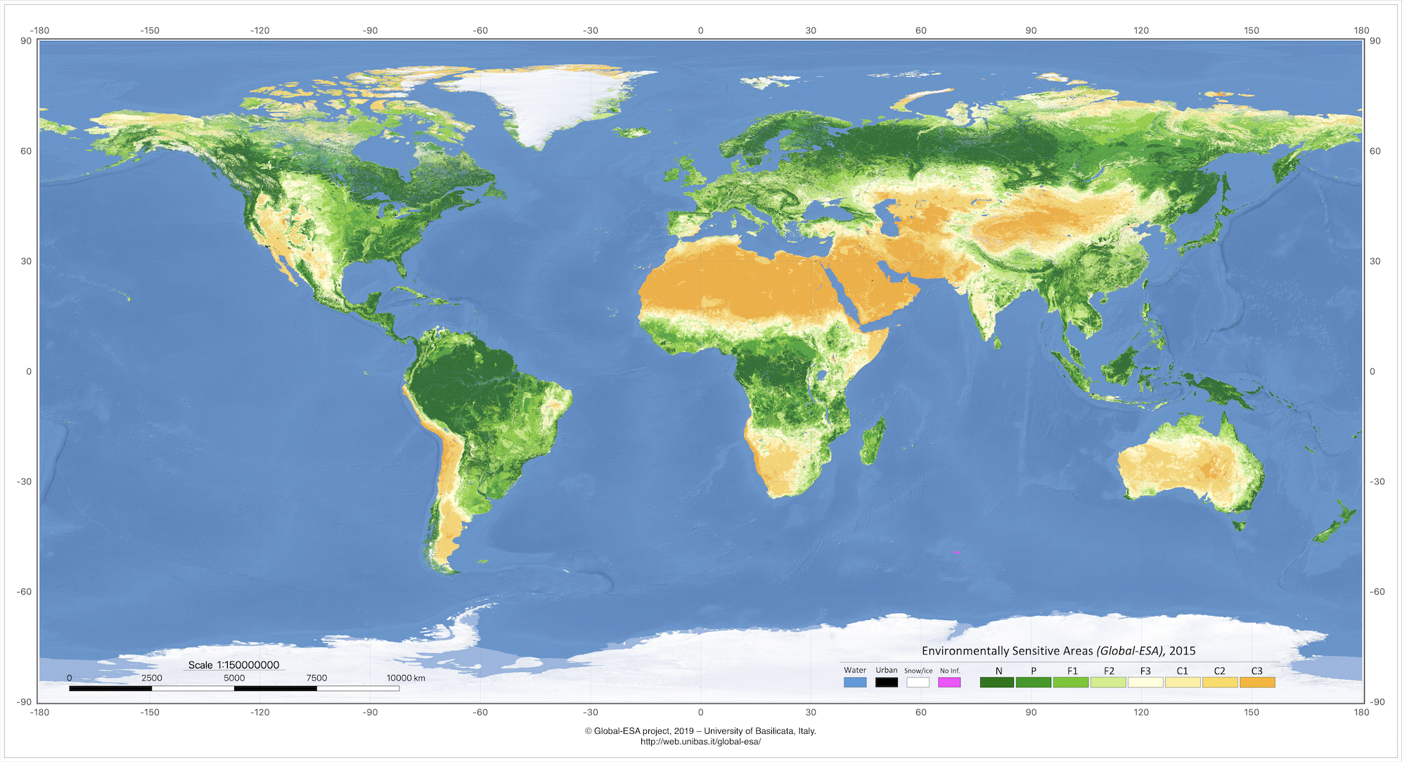
The 2015 worldwide Environmentally Sensitive Areas (Global-ESA).
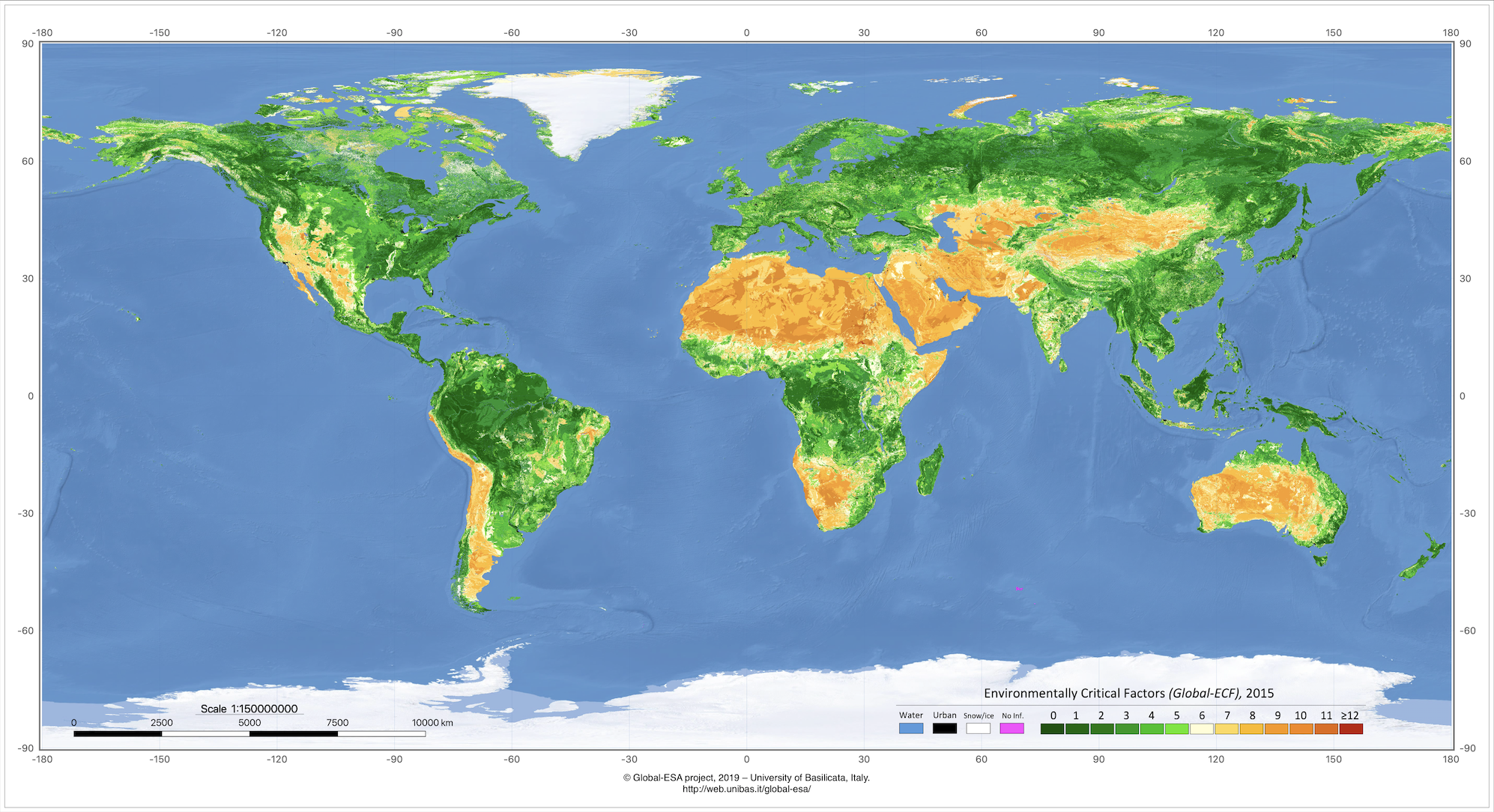
The 2015 worldwide Environmentally Critical Factors (Global-ECF).
The 2010 worldwide Environmentally Sensitive Areas (Global-ESA).
The 2010 worldwide Environmentally Critical Factors (Global-ECF).
The 2005 worldwide Environmentally Sensitive Areas (Global-ESA).
The 2005 worldwide Environmentally Critical Factors (Global-ECF).
The 2000 worldwide Environmentally Sensitive Areas (Global-ESA).
The 2000 worldwide Environmentally Critical Factors (Global-ECF).
(maps for the year 2020 are planned for late 2023, depending on data availability)
|